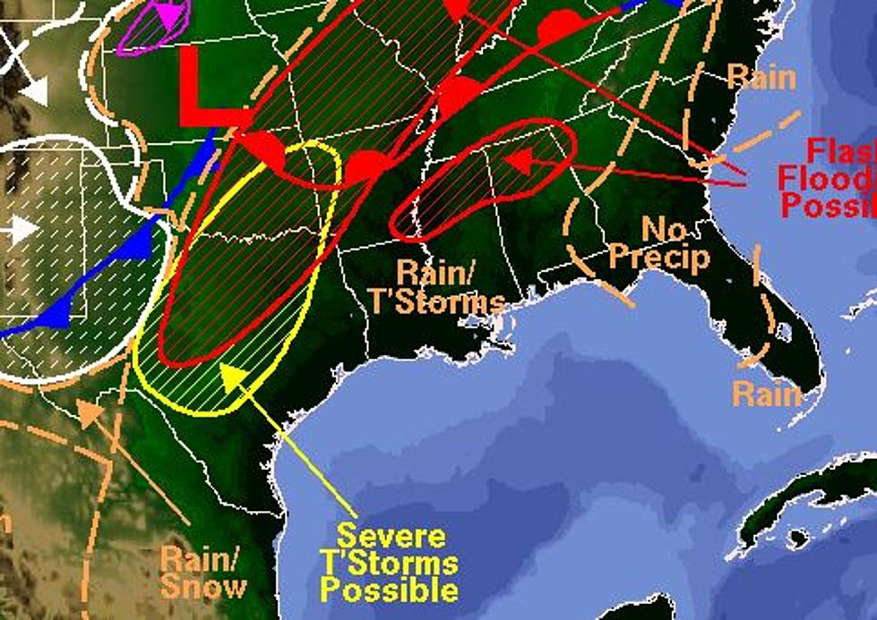
Heavy Thunderstorms Expected Across South Louisiana Today
The Storm Prediction Center in Norman Oklahoma has revised its forecast of where the greatest threat for severe weather might occur today. That revision has taken much of South Louisiana out of the enhanced area and placed us in the slight risk for severe weather area. Regardless the afternoon and early evening hours across the area will likely see strong storms with heavy downpours, gusty winds, frequent lightning, and there is a possibility of tornadoes as well.
Early this morning a strong low pressure system now located over the Great Plains is dragging a cold front and associated squall line through northern and central Texas. This line of storms is expected to remain intact and possibly grow strong as the entire system migrates rapidly to the east.
As of 4am National Weather Service radar in Dallas/Fort Worth indicated a very strong line of storms pushing through the Metroplex. This could affect early morning air travelers out of Lafayette and Lake Charles that have connections at DFW. There have been severe weather watches and warnings associated with this line as it moved through the Big Country region of the Lonestar State.
The early morning radar scan from the National Weather Service in Lake Charles shows a rather quiet morning but that will undoubtedly changes as the day wears on. You can expect conditions to worsen from the west by early this afternoon as showers and thunderstorms begin to move into the area. The best chances rain and heavy weather will move into the area around the middle of the afternoon with the threat of heavy rain and storms lasting into the overnight hours.
More From Classic Rock 105.1


