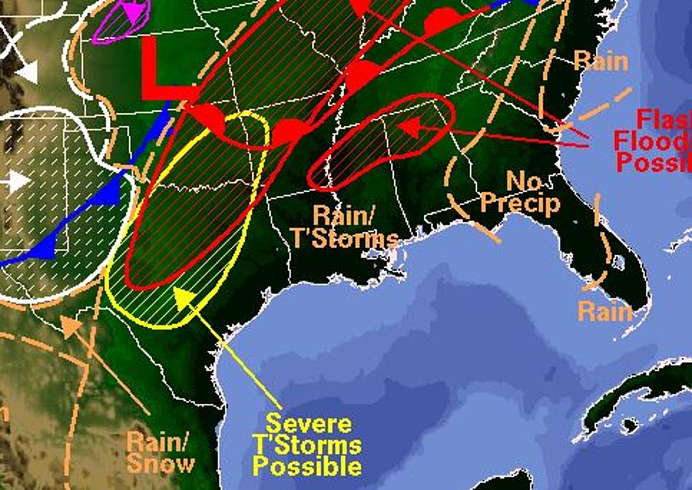
Another Wet Weekend For South Louisiana
The past two weekends have brought frog-strangling rains to South Louisiana. This weekend we might not see the deluge that we saw last weekend but chances are you're going to want your rubber boots and umbrella handy.
A slow moving frontal system is poised to push through the state beginning late today and through Saturday. Mike Marcotte, a forecaster with the National Weather Service in Lake Charles, told the Louisiana Radio Network the next day or so will likely be wet.
We’re looking at rainfall amounts common, one and half to possibly three and a half inches. We’ll always include the verbiage that we could see isolated higher amounts in a few areas.
While these rainfall amounts are not extraordinary, when you put the additional rainfall on top of the heavier rains the area has seen over the past two weekends there will be some flooding concerns.
We’ve had a couple of episodes of very heavy rains. We are concerned about the possibility of excessive rainfall that might call some flooding.
This type of weather pattern that we've been seeing lately is typical of a strong El Nino year. El Nino is a weather pattern that develops over the United States when waters in the Pacific Ocean are at an above-normal temperature.
If you're looking for colder weather to make it actually feel like November you may not have to wait too much longer. While the upcoming week will be cooler, the really colder weather will likely be here before election day.
More From Classic Rock 105.1


