Severe Storms, Tornado Threat Elevated for Louisiana Today
Residents of Louisiana from Lake Providence near the Mississippi line to Vinton near the Texas line are gearing up for what could be a bumpy ride during the day today and especially tonight. The National Weather Service and the Storm Prediction Center have elevated the severe weather risk for Louisiana and much of the Gulf South today and tonight.
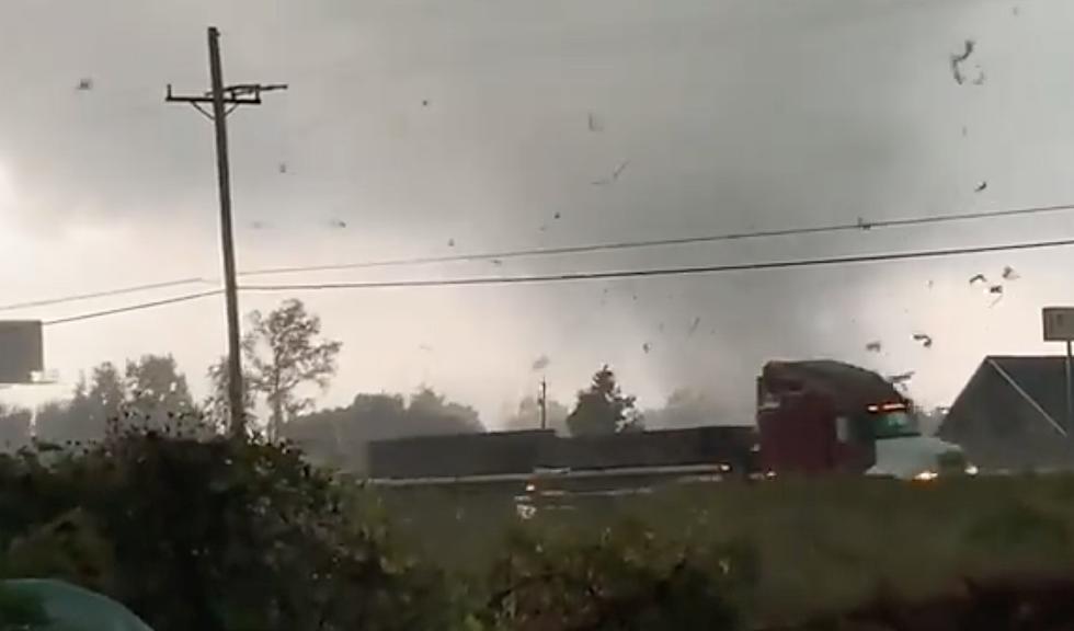
A cold front that has already had a history of producing severe storms and tornadoes is poised to push across Louisiana during the day today and later this evening into the very early hours of Friday morning. This storm system is responsible for deadly tornadoes that killed two people in Tennesee and one in North Carolina on Wednesday.
Here is where the Storm Prediction Center believes the worst of the weather will occur across the nation today.
Compared to the SPC outlook that was issued just one day ago the "Enhanced Threat" has expanded from only central Texas to much of East Texas, all of northern Louisiana, and a large portion of central Mississippi and Alabama. The "Slight Risk" has also been expanded from yesterday to include more of southern Louisiana including the cities of Baton Rouge, Lafayette, and Lake Charles.
The National Weather Service Forecast Office in Lake Charles offers a graphic, below, that allows you to see more clearly where the anticipated threats will be closer to home.
The "good news" with this updated forecast is the tornado threat. Forecasters believe the threat of rotating storms in South Louisiana will be minimal. But that doesn't mean there won't be storms capable of producing one of those violent weather events.
The most significant threats for South Louisiana are damaging winds and small hail. There will be a risk of significant downpours that could create flash flooding or at least some ponding of water on roadways during the height of the storms. The greatest threat of an Excessive Rain Event will likely occur north of US 190 with most of the heavier storms occurring along and near the I-20 corridor in Louisiana.
Heat will be an issue in Louisiana today as daytime highs will be near or above 90 degrees in many locations. That could mean a heat index of 103 for some places in the state this afternoon. Forecasters anticipate a slight cool-down after the cold front moves through the area late tonight and early Friday morning.
The next threat of showers and storms for the area will come late in the day on Sunday. Forecasters do anticipate a chance of showers and perhaps more strong storms during the day on Monday.
5 Cheapest Homeowners Insurance Providers in Louisiana
More From Classic Rock 105.1