
Tropical Storm Dorian Expected To Become Hurricane This Week
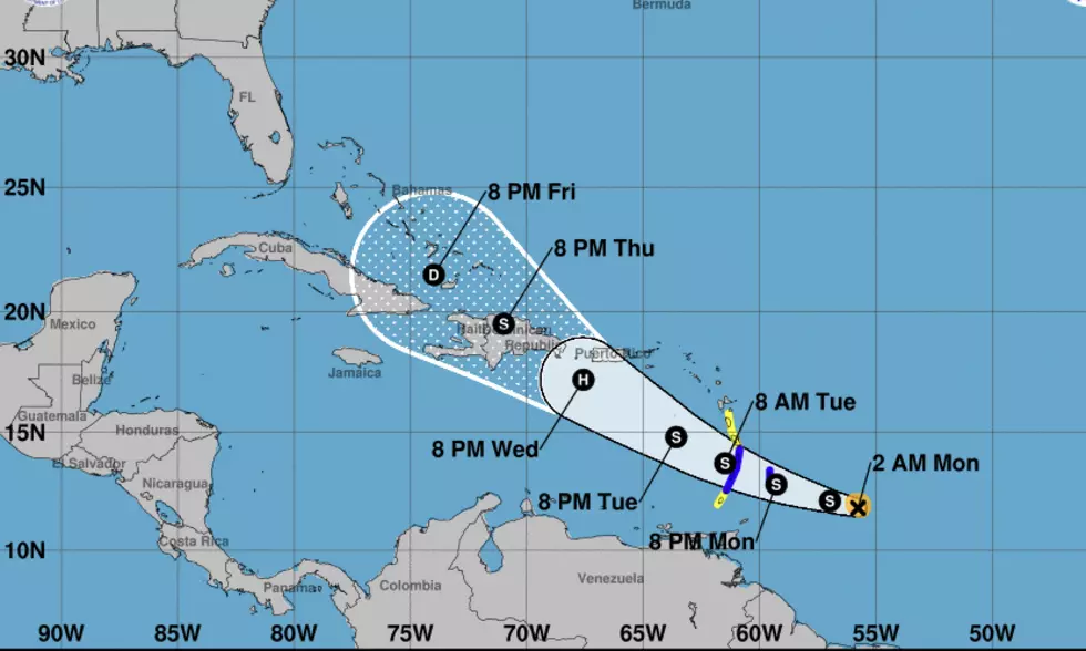
Forecasters with the National Hurricane Center are watching Tropical Storm Dorian for further development as the system approaches the Leeward Islands this morning. Outer rain bands from the system which formed late last week from a tropical wave are expected to impact the easternmost islands by as early as tonight.
Forecasters to predict that Dorian will strengthen into a category 1 hurricane by Wednesday. The current forecast track brings Dorian into the Eastern Caribbean Sea as a strong tropical storm. It will then strengthen to minimal hurricane status as it approaches the island of Hispaniola.
The impact with the mountains on that island and changes in atmospheric conditions are expected to weaken Dorian by Wednesday as it moves into the Bahamas. Tropical forecast models are currently keeping the system to the east of the Florida peninsula. This would be good news for the Gulf Coast but maybe not such great news for the Eastern United States.
However, should that storm track slide slightly to the west we could be looking at a tropical system in the Gulf of Mexico for Labor Day Weekend. Just like the Old Farmers Almanac predicted.
More From Classic Rock 105.1


