
Strong Storms Expected in Acadiana Today
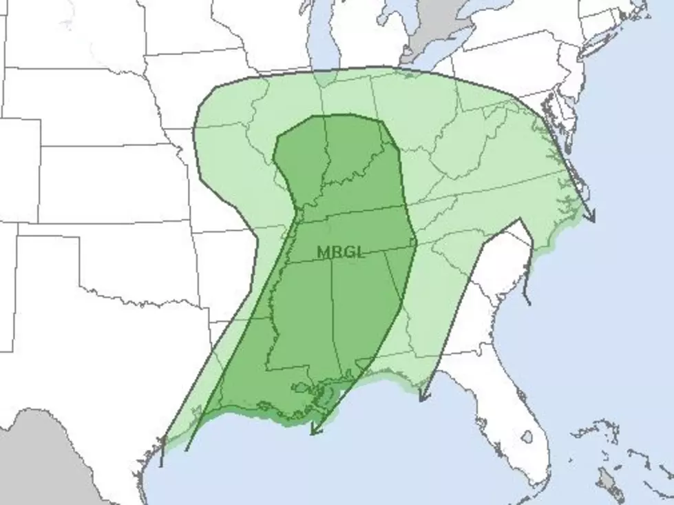
The Storm Prediction Center in Norman Oklahoma has placed almost all of Louisiana in the "marginal risk zone" for severe weather during the day today. Based on weather radar data from Shreveport, it's pretty easy to see why.
That line of thunderstorms you see on the Shreveport radar scan is forecast to keep moving to the east and southeast over the next several hours. Forecasters say that some of the storms within that line could reach severe limits later today.
Based on model guidance it appears as if Acadiana's best chance of severe weather will come as the front approaches. We should start to see shower and thunderstorm activity on the increase over the next several hours. As of now, the best guess timing on when the worst of weather will move through is about noon.
Behind the front, we won't get that much of a break temperature-wise. In fact, the front is supposed to move back through the area as a warm front later in the day on Thursday. Then things really get interesting as head into the first official shopping weekend of the holiday season.
The sub-tropical jet stream, a fast-moving river of air in the high altitudes, is forecast to pick up a couple of disturbances and move them over south Louisiana late Friday and through the weekend. These disturbances will greatly enhance our rain chances.
As of now, model guidance seems to suggest the heaviest rain will fall on Saturday afternoon and evening into Sunday. We could see a couple of inches of rain or maybe a little more in some spots before the end of the holiday weekend.
Now, comes the good news for those that want to do their holiday shopping and light looking with a coat on. Cooler temperatures, in fact, downright cold temperatures are forecast for the area next week. So, after a wet Thanksgiving weekend, it will begin to feel a lot more like Christmas.
10 Old School Christmas Specials That Hit You in the Feels
More From Classic Rock 105.1
