
Severe Storms Possible Later Today and Wednesday
Forecasters with the Storm Prediction Center are watching a slow-moving storm system across the nation's midsection this morning. This frontal boundary is expected to slowly creep into Louisiana during the day today and eventually stall out. That frontal boundary and subsequent areas of low-pressure that are expected to develop along that boundary have given forecasters a reason to be concerned about the development of severe weather.
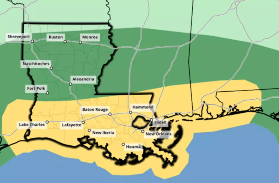
For today much of South Louisiana is under a marginal threat for severe storms to develop. During the day on Wednesday, that threat is expected to be more likely as forecasters with the National Weather Service say the area will be under a slight risk of severe storms.
Showers and thunderstorms are expected to develop across the region later this afternoon. That threat of showers and thunderstorms will increase as the evening hours wear on. By tomorrow almost all of South Louisiana can expect showers and thunderstorms. Some of those storms will contain frequent lightning, gusty winds, and the threat of tornadoes.
Here's what some of the computer models are suggesting as far as rainfall totals are concerned.
And Chief Meteorologist for KATC, Rob Perillo is suggesting that at least some parts of Acadiana will be placed under severe weather watches and or warnings during the day on Wednesday.
The system is expected to exit the area by late Wednesday night or early Thursday morning. Behind the system winds will become quite gusty out of the north and temperatures will be a little cooler when compared to the temperatures that we will see t his afternoon.
The outlook for the week across South Louisiana looks to be mostly sunny with slightly cooler temperatures.
More From Classic Rock 105.1
