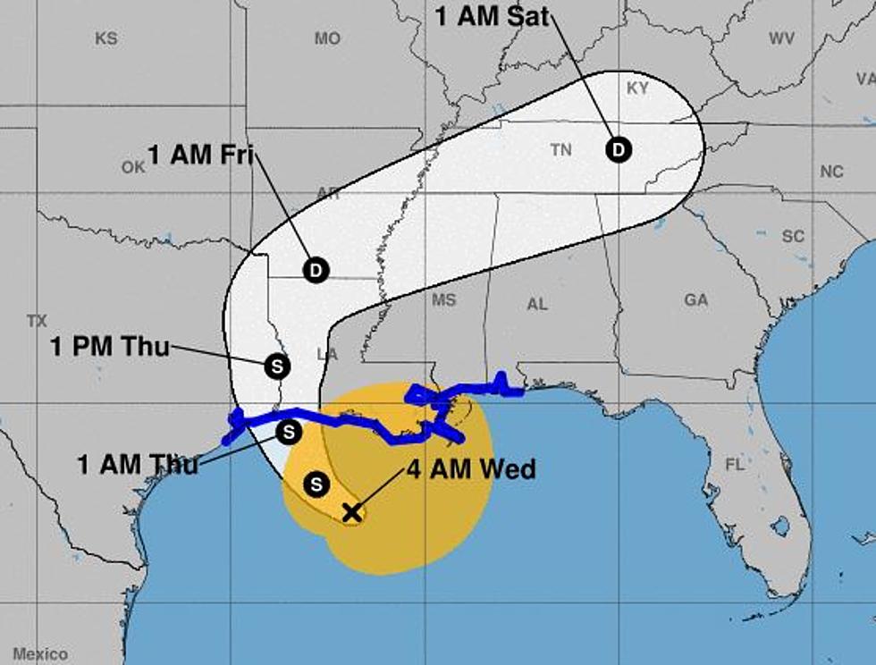
Landfalling Cindy Still Poses Severe Weather Threat
All it takes is a quick glimpse of the National Weather Service Radar loop from Lake Charles and you can see where Tropical Storm Cindy happens to be. The radar certainly shows that rotation of storms around the center of circulation that is a trademark of a tropical system.
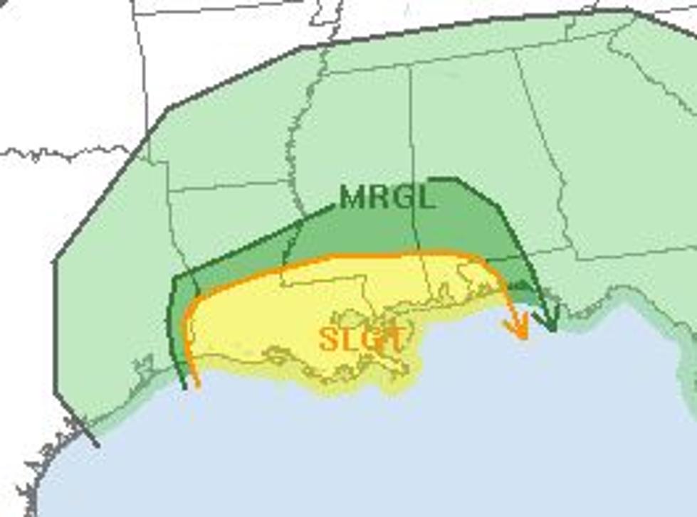
One other trademark of landfalling tropical cyclones is the threat of tornadoes. That threat along with the potential for severe thunderstorms will persist across the eastern two-thirds of Louisiana today.
According to the Storm Prediction Center, there is a slight risk of severe weather and possible tornadoes. Most of those storms will be located within rapid moving rain bands swirling around Cindy's center of circulation. Quite often these rain bands and strong supercell storms within them can quickly spin up tornadoes.
As of early this morning, National Weather Service has issued a tornado watch for the eastern sections of Acadiana and the remainder of southeast Louisiana. This tornado watch affects Iberia, St. Martin, St. Landry, and St. Mary Parishes as well as the adjacent coastal waters of the Gulf of Mexico. The watch will remain in place until 1 PM Thursday.
The good news is this. Cindy should start to weaken even more as the system moves over land. This should reduce the severe weather threat and eventually return the area to a more typical Summer forecast of Partly Cloudy skies, hot and humid conditions, and a threat of a pop-up thunderstorm.
More From Classic Rock 105.1


![Cindy Hits Cameron, Moves Toward Lake Charles – [VIDEO]](http://townsquare.media/site/149/files/2017/05/ryan-street-flooding.jpg?w=980&q=75)
![Wire Dangling From Station Tower, This Can’t Be Good [VIDEO]](http://townsquare.media/site/34/files/2017/06/Screen-Shot-2017-06-22-at-6.39.12-AM.png?w=980&q=75)