Another Slightly Eastward Nudge as Hurricane Ida Approaches Louisiana Coast
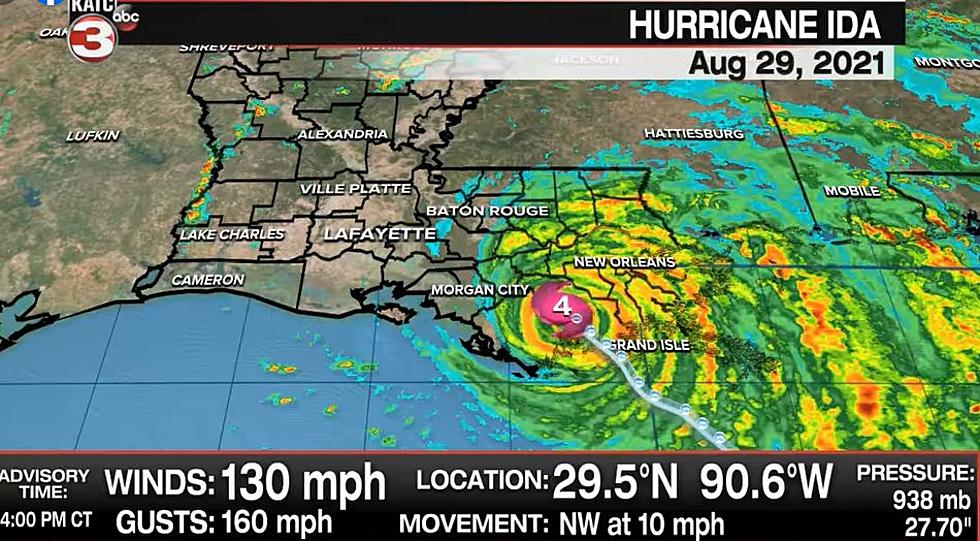
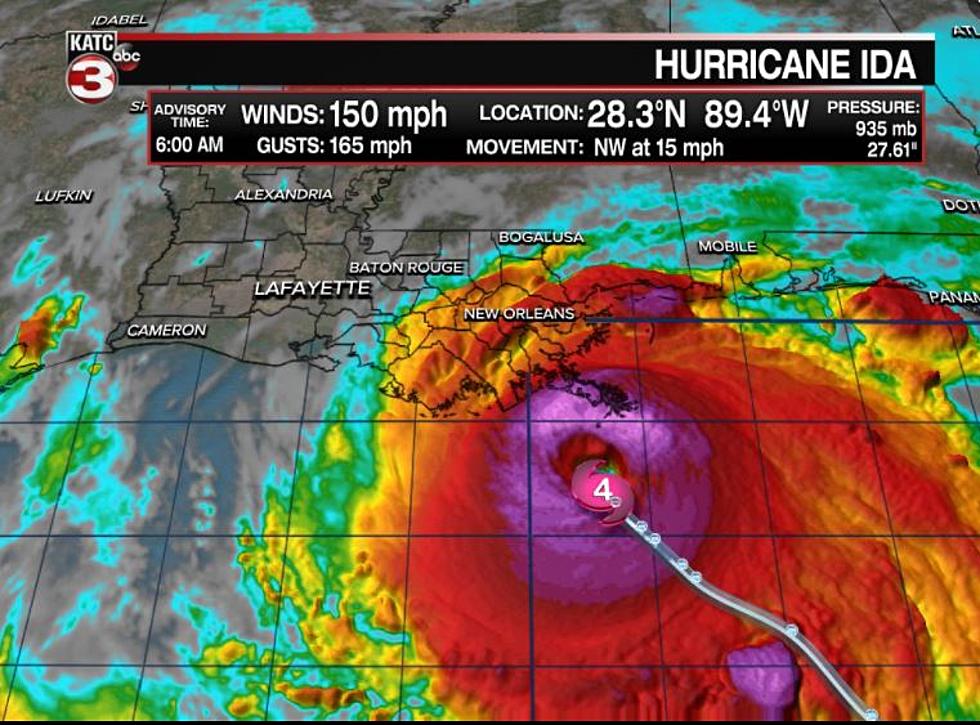
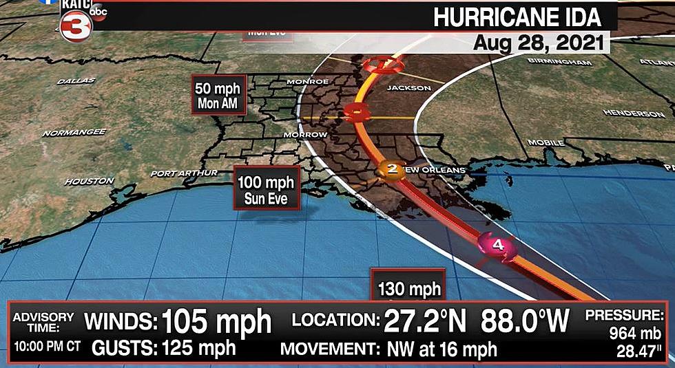
Hurricane Ida continues its slight eastward nudge on Saturday as the powerful Category 2 storm spends its final night in the Gulf of Mexico before making landfall near the Lafourche/Terrebone line in Louisiana Sunday afternoon or evening.
As of the 10 PM Advisory from the National Hurricane Center, Ida continues to pack 105 mph winds with gusts of 125 mph.
As KATC Chief Meteorologist Rob Perillo points out, this is better news for Acadiana, especially coupled with the slight nudge east that the 4 PM Advisory revealed.
The National Weather Service displayed the improved numbers, which are broken down parish by parish below in four different categories - Wind, Storm Surge, Rainfall Totals, and Tornado Threat.
Of course, these nudges east mean hurricane conditions are becoming more likely into New Orleans.
A Hurricane Warning is in effect for...
* Intracoastal City Louisiana to the Mouth of the Pearl River
* Lake Pontchartrain, Lake Maurepas, and Metropolitan New Orleans

A Tropical Storm Warning is in effect for...
* Cameron Louisiana to west of Intracoastal City Louisiana
* Mouth of the Pearl River to the Alabama/Florida border
While Ida is currently heading northwest from the Gulf of Mexico towards the Louisiana coast, it is expected to make a northern turn on Sunday, then make a northeastern turn on Sunday evening.
LIST: 10 Deadliest Louisiana Hurricanes
Six Things A Cajun Needs To Survive A Storm
Aerial Pictures of Southwest Louisiana Before & After Hurricane Laura
Things You Want or Need After Surviving A Hurricane
More From Classic Rock 105.1
![Louisiana Family Living in Vehicle After Hurricane Ida Destroys Home [VIDEO]](http://townsquare.media/site/34/files/2021/09/attachment-Screen-Shot-2021-09-29-at-7.43.01-AM.jpg?w=980&q=75)
![Lafourche Parish Residents Say They’re Now Living in Polluted Mud [PHOTOS]](http://townsquare.media/site/34/files/2021/09/attachment-Screen-Shot-2021-09-20-at-4.46.56-PM.jpg?w=980&q=75)


